





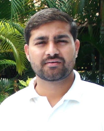
By Dr Zawwar Hussain
Water has always been more than a natural resource. It is the foundation upon which societies are built, economies grow and civilizations survive. From ancient settlements that emerged along rivers to modern cities dependent on complex water systems, human progress has always been tied to the availability of clean and reliable water. Yet in the twenty-first century, water is becoming one of the world’s most vulnerable resources. Population growth, climate change, uncontrolled urban expansion, industrial pollution and environmental destruction are turning what was once considered an abundant gift of nature into a defining challenge for humanity.
The global water crisis is no longer a distant warning. Millions of people already struggle to access safe drinking water, while rivers, lakes, wetlands and groundwater reserves are facing unprecedented pressure. The United Nations has repeatedly highlighted that billions of people worldwide experience difficulties in accessing safely managed water, while pollution and climate-related disruptions continue to threaten the quality and availability of freshwater resources.
The challenge is particularly severe in developing countries, where rapid population growth and economic pressures often move faster than environmental protection systems. Pakistan is among the countries facing growing water insecurity. Once considered a water-rich nation because of its extensive river network and glacier-fed resources, Pakistan now faces declining water availability, increasing pollution and growing competition among agriculture, industry and domestic users.
For decades, governments and environmental agencies have relied on conventional methods to assess water quality. These methods usually involve collecting samples from rivers, lakes or reservoirs and sending them to laboratories for detailed chemical and biological analysis. While laboratory testing remains essential because of its accuracy, it has serious limitations. It requires time, financial resources and extensive manpower. More importantly, it only provides information about specific locations at specific moments. By the time pollution is detected, contamination may have already travelled across large areas, making effective response far more difficult.
This traditional approach is increasingly unable to address the scale and speed of modern environmental challenges. The solution lies in embracing a new generation of technologies that can observe, analyse and predict changes in water systems before they become irreversible.
Satellite-based water quality monitoring has emerged as one of the most promising developments in environmental science. Through the combination of satellite imagery, Artificial Intelligence, Machine Learning, Geographic Information Systems and advanced modelling techniques, scientists can now monitor vast water bodies with a level of detail that was unimaginable only a few decades ago.
Satellites orbiting the Earth continuously capture information about rivers, lakes, reservoirs and coastal waters. Unlike ordinary cameras, satellite sensors can detect different wavelengths of reflected light, allowing researchers to identify changes that are invisible to the human eye. These observations help measure important water quality indicators, including turbidity, sediment levels, algae concentration, water temperature and organic pollution.
The significance of this transformation cannot be overstated. In the past, monitoring thousands of square kilometres of water resources required enormous human and financial resources. Today, Earth observation satellites provide regular information about large geographical areas, allowing scientists to identify environmental changes more quickly and efficiently.
However, satellites alone cannot provide a complete understanding of aquatic ecosystems. Water quality is influenced by a complex combination of natural and human factors, including rainfall patterns, industrial activities, agricultural practices, river flows and changing climate conditions. For this reason, modern monitoring systems increasingly rely on the integration of multiple sources of information.
This approach combines satellite observations with drone surveys, ground-based sensors, laboratory testing, weather data, geographical information and hydrological models. Each source contributes a different strength. Satellites provide wide coverage, drones offer detailed local observations, sensors deliver continuous measurements, while laboratories provide accurate scientific verification.
The real breakthrough has come through Artificial Intelligence, particularly Machine Learning. Instead of depending only on traditional calculations, machine learning systems can examine enormous amounts of historical and current data, identify hidden patterns and improve their predictions over time.
When satellite images are combined with thousands of laboratory measurements, artificial intelligence systems can learn the relationship between what satellites observe and the actual condition of water. Once trained, these models can estimate water quality conditions rapidly and accurately, reducing dependence on slow monitoring processes.
Technologies such as Artificial Neural Networks, Random Forest algorithms, Gradient Boosting and other machine learning methods are already being used around the world to improve environmental decision-making. Their greatest advantage is their ability to transform complex data into practical information that governments and communities can use.
The combination of Artificial Intelligence and satellite monitoring also changes the way environmental crises are managed. Instead of discovering pollution after serious damage has occurred, authorities can identify warning signs at an early stage. This allows faster action against industrial contamination, harmful algal blooms, unsafe drinking water conditions and other ecological threats.
(The writer is a PhD scholar with a strong research and analytical background and can be reached at news@metro-Morning.com)
